About the project
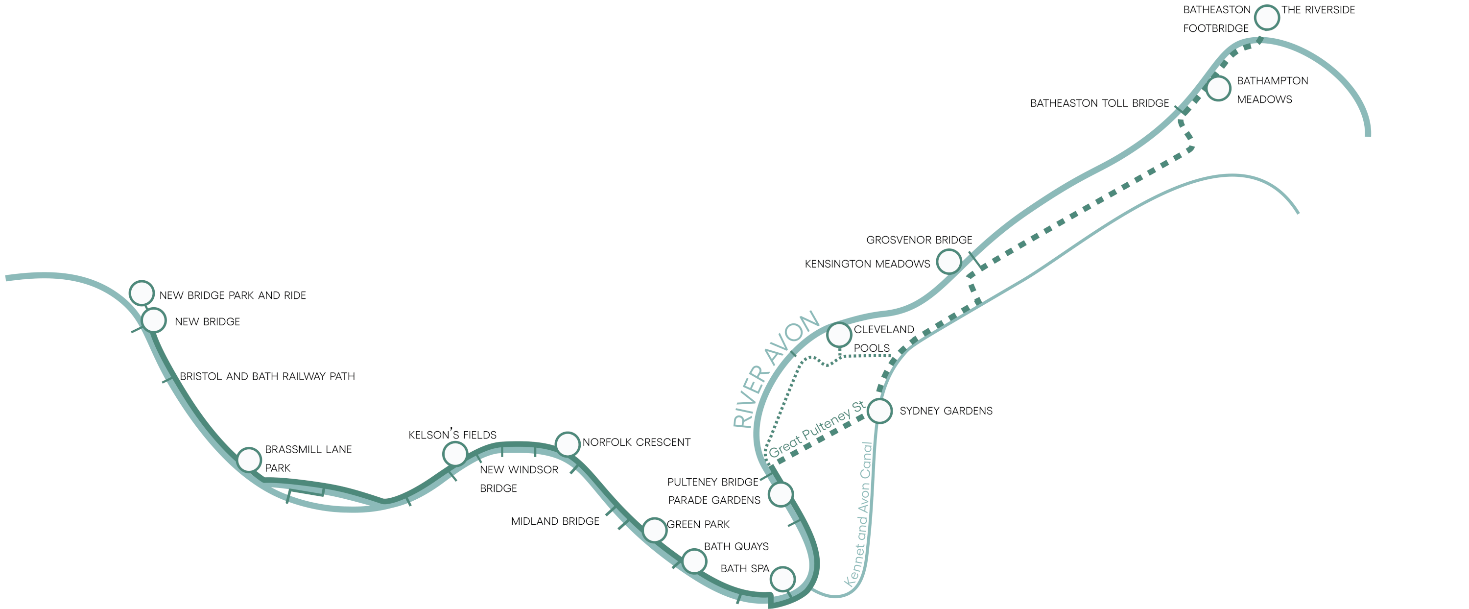
The Bath River Line (BRL) will create a linear park following the River Avon from Batheaston to Newbridge. Covering 10km, the BRL will connect beautiful green spaces and iconic landmarks, tempting pubs and peaceful water meadows.
Creating a high-quality route for walking and cycling is key. But the BRL will also offer opportunities to stop, sit back and enjoy the beauty of the river, the city, and the landscape beyond.
There will be places to play and places to meet, places for art and spaces to discover Bath’s rich heritage. The wildlife found along the river will be celebrated and protected.
By revealing the Avon in all its glory, the Bath River Line will go beyond the Georgian glamour to explore a lesser-seen side to the city.
This project is designed to give people a bigger say and will also help to address the climate and ecological emergency.
Due to the size of the Bath River Line project, it will be taken forward in phases.
The first phase covers the western section, from Newbridge to Bath Quays. A later second phase will consider the eastern section (from Pulteney Weir to Batheaston) and a final phase will consider the central section, from Bath Quays to Pulteney Weir.
Phase I: Bath River Line West
Phase 1 will focus on the western side of the city and run from Newbridge to Bath Quays. This phase has been funded with support from the West of England Combined Authority, development contributions and B&NES.
A series of interventions will be delivered across the whole route, including to the path, adjacent parks and public spaces. Interventions included in this phase include upgraded access points, improved wayfinding and interpretation, pollinator and insect friendly planting, new benches, and upgrades to the path.
This will help create a much richer and pleasant riverside environment where users can take time to experience and enjoy the river and its wildlife at one of our new or improved dwell spaces or enhanced parks and green areas.
Construction of Phase I of the Bath River Line will commence in summer 2024. If you have any questions or queries about Bath River Line, contact riveravon@bathnes.gov.uk.
How we got here
The idea for the Bath River Line emerged from the WaterSpace Project – a collaboration between Bath & North East Somerset Council, the Canal and Rivers Trust, the Environment Agency and Wessex Water.
Published in 2017, the WaterSpace Study identified a series of projects to revitalise the River Avon and Kennet & Avon Canal waterways for people and nature. The River of Avon Park (as it was known) eventually became the Bath River Line: a linear riverside park for Bath.
For more information on the WaterSpace Project and to read the original study, please click here.